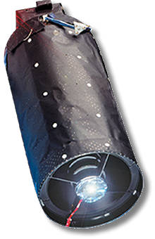
EROS provides an important insight into the Israeli space imaging capability. According to ElOp, the camera currently deployed on Eros A is operating at an altitude of 500 kilometers, and is capable of taking high-resolution pan-chromatic pictures of an area of 14 x14 kilometers, at a resolution of 1.9 meters.

However, applying unique scanning methods called “over-sampling” techniques, carried out by the manufacturer, have already doubled the system’s performance, providing imaging of a 10×10 kilometer area at resolution of 1 meter with the existing satellite, with vertical separation of 5 meters, providing accurate mapping and 3D modeling capability of the terrain.
The next satellite in the EROS series, called EROS B launched April 25, 2006 is equipped with a pan-chromatic sensor capable of an initial resolution of 0.70 meters, from an altitude of 500 kilometers.
Menashe Broder, CEO of ImageSat told Defense Update that the company is considering launching the satellite to an altitude of 500 kilometers, at the initial phase of its lifespan, to yield higher resolution imagery, if market demands will dictate higher resolutions. ImageSat is offering clients around the world to share the satellite resources and control the payload of the satellite when it flies over their area of interest by becoming Satellite Operating Partners (SOP). This scheme provides customers with near-real-time imagery, which is processed and distributed from a local ground station during the satellite’s overflight of the area. According to Noam Zafrir, VP Marketing at ImageSat, clients can also order imagery of specific locations, which is provided by the company upon request, with rapid response times, unparalleled in the world market.


