Start < Page 1 of 6 >
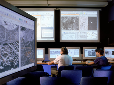
UAV and their sensors are only part of the Intelligence, Surveillance and Reconnaissance (ISR) “big picture”. Completing that concerns processing, storing and retrieving the data into actionable intelligence. Utilizing modern commercial off the shelf (COTS) technology, sensor data can be rapidly processed. Correlated to geographical grid, and merged with live and stored images, imagery and spatial information including EO, SAR, MTI maps, SIGINT and ESM can be fused and presented over common map display, showing a detailed and accurate multi-dimensional situational picture. The use of ISR products is not limited to intelligence analysts, but can also be used by warfighters in the field, using tactical computer terminals and PDAs. Prior to delivery products are trimmed, wrapped, and compressed to adapt to narrow-band wireless communications.
Presently, “stovepipe” systems are employed to provide intelligence. These include various airborne and ground based sensors, such as Global Hawk and Predator UAVs, Joint STARS ground surveillance systems and various ELINT/COMINT assets. Each system is operated separately, utilizing specific sensors, airborne and ground based processing and exploitation systems. The refined intelligence is shared at a higher level, where it supports operational planning and ongoing operations.
Additional parts of this article:
- Turning raw data into actionable intelligence
- Enhanced Vision Systems
- Target Geolocation
- Computer Mapping & Modeling
- Automatic Change Detection
- Convoy protection and IED patrols


