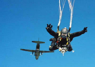
A commando team of paratroopers is dropped at night from an altitude of 32,800 feet (10,000m) ready to take up position in an ordered group around a target 31 miles (50 km) away. A few seconds later, the aircraft proceeds to drop their all-terrain vehicles and equipment in a controlled manner. Suspended from rectangular parachutes equipped with an automatic guidance system, they land close to the troops. The commandos and their equipment reach the area exactly as planned and can start operations without delay.
It may sound like science fiction, but this scenario is likely to become reality in the near future thanks to ParaFinder and ParaLander, two mission systems allowing paratroopers and their equipment to land with exceptional precision in time and space, even if dropped far away from their target from a high altitude of up to 10,000 meters. Forces using ParaFinder and ParaLander can intervene remotely from any airfields in zones lacking any handling and transport infrastructures. ParaLander can be used equally well for civil and humanitarian operations. The German army received the first ParaFinder systems in 2006, supplied under a €7.45million contract awarded in 2003.. Initial deliveried were destined to the special operations division (DSO), the Special Forces command (KSK) as well as units of paratroopers and naval frogmen.
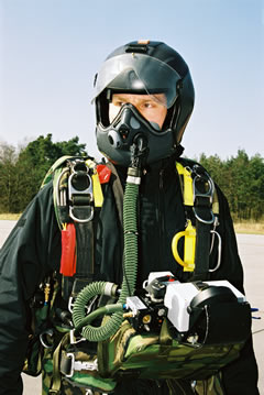 “A paratrooper using ParaFinder “is essentially equipped with all necessary flying instruments,” observes Jens Gönnemann, head of systems development and testing at EADS Defence & Security Systems. The first country to acquire this system, Germany, decided in the fall of 2003 to equip its special forces with it. ParaFinder and ParaLander. Using satellite based GPS navigation and automatic guidance and control, these autonomous precision aerial delivery systems could covertly guide men and materials precisely to predefined landing zone keeping the transport aircraft remote from this area, operating outside the reach of the enemy’s air defenses. The paratroopers and their loads are silent, have a small radar reflection and are virtually impossible to detect, especially at night. Utilizing the new navigation systems, insertion can be performed under all weather conditions, assuring soft, risk-free landing.
ParaFinder has been designed around two components: the mission planning calculator and the navigation assistance unit. The calculator processes the main jump parameters such as wind direction as a function of altitude. “For the paratrooper, the navigation assistance unit takes the form of an interactive visor which guides him to his planned landing point,” adds Jens Gönnemann who has already jumped with the demonstration prototype. The ParaFinder and ParaLander concept will certainly find other applications, not just by virtue of its satellite navigation system. Infantrymen acting within a network-centric operations architecture may also benefit from the technologies developed for the two systems, particularly the interactive visor.
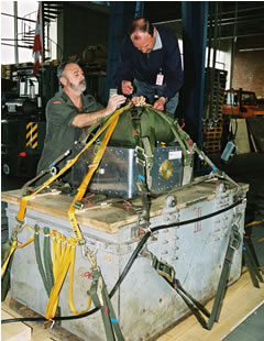
The same architecture and mission planner is used to deploy light, medium or heavy loads ranging from 2,200 to 13,000 lbs (1 to 6 ton) with the ParaLander. The system entered operational use with eth German Army in 2006.

