AUSA, Washington DC, October 2009: An important aspect of military operations in counterinsurgency and stabilization operations is understanding the ‘human terrain’ – the environment which the unit is operating in. Deciphering this subtle social matrix is an anthropological challenge, and has never been part of the military commander’s skill set. However, these social domains are the terrain on which asymmetric conflicts are fought and won, and as such, military commanders should be prepared to assess the situation, avoid obstacles and seize the ‘high ground’, by solving some of the issues most concerning and critical to the local population.
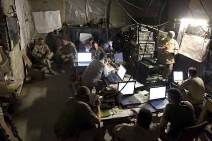
In recent months Human Terrain Teams (HTT) have been embedded with combat units in Afghanistan, assisted with tactical, geospatial systems to learn, understand and interact with the local population. HTTs consist of soldiers, trained sociologists and anthropologists and regional experts, supported by U.S. based center of expertise providing a ‘Reachback’ pool of knowledge. Assisted by advanced technology, officers are able to rely on new software tools developed under the ‘Mapping the Human Terrain (MapHT) – a Joint Capability Technology Demonstration (JCTD) managed by the Office of Secretary of Defense (OSD). The system transforms random and disconnected events into more predictable and actionable decision-making process. The HTS program is the first systematic application of social science research at the tactical brigade level. MAP-HT is currently undergoing evaluation in Afghanistan and is scheduled for fielding with all teams through 2010.
Part of the Human Terrain System (HTS), MapHT is developed by BAE Systems, implementing the Tactical Ground Reporting System (TIGR) for reporting and services derived from Distributed Common Ground Systems – Army (DCGS-A), developed by Overwatch Technology, for data management and retrieval.
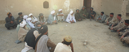
MapHT provides commanders with an understanding of socio-cultural information that can be integrated into the decision making process, assessing course of action within the cultural and social context of the target area. The system accesses and generates a situational understanding from surveys, interviews, patrol debriefs, human intelligence from local sources, ethnographic reports etc. Preparing and reporting on Shura meetings with local elders and religious leaders, encounters with local villagers and business owners. Post event reports can be shared with other elements in the area, having access to similar TIGR map-based reporting systems. Utilizing various analysis tools and access to expert and specialist support, commanders can develop more focused courses of action, apply feedback tools to measure and assess ‘human terrain’ operational effectiveness which assist in further improving the system’s operational model.


