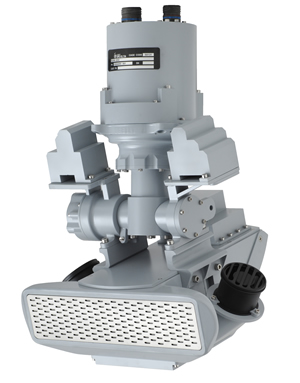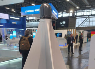

IAI Elta is introducing a new version of their lightweight Synthetic Aperture radar (SAR) Ground Moving Target Indicator (GMTI) sensor designated EL/M-2054. The new radar is based on another Elta SAR radar, the EL/M-2055DX modular SAR/GMTI radar, The new version is designed specifically for small form and size, low weight and power consumption, making it suitable for small, tactical unmanned aerial systems (STUAS) and Tactical Vertical Take-Off and Landing (VTOL) platforms, light reconnaissance aircraft and aerostats. The new radar employs an open architecture for rapid integration and configuration to meet the requirement of different platforms and applications.
The range of the new radar exceeds 10km (depending in the operating mode) operating in day, night and under adverse weather conditions. Coverage in SAR Strip is 360 km2/hour, while persistent surveillance in the GMTI covering about 25 square kilometers. A typical installation in a small tactical UAV weighs about 12 kg and consumes 250 watts.
Sofar Elta has offered two versions of the EL/M-2055 SAR/GMTI sensor. One designed for Medium Altitude Long Endurance platforms (MALE), weighing 66 kg and consuming 1.1 kilowatt and the other, for tactical UAS, weighing 36 kg, consuming 700 watts of electrical power.
The EL/M-2054 offers advanced capabilities derived from more compact and efficient electronics and signal processing capabilities. Its airborne segment is provided with on-board data processing system and cross-cueing of radar data to or from EO/IR and other sensors. The two operating modes of the radar (Strip/Spot) provide sufficient resolution and definition to detect and classify stationary targets, while covering a large area. The GMTI mode supports the detection
of ground targets over a wide range of velocities using enhanced, dual-band capability.
The data exploitation segment associated with the new system is providing advanced mission analysis tools enabling advanced imagery and GMTI exploitation supporting the tactical level. These include automatic geo referencing of images, computer aided target detection, tracking and classification, automatic change detection, imagery data manipulation, annotation and mensuration.


