Interoperability of airborne SAR, and Ground-Based Image Processing Systems Empower Global Hawk, Joint STARS to Process, Distribute Radar Imagery through DCGS-I
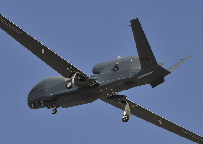
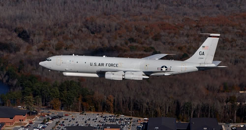
Northrop Grumman Corporation recently completed a successful exchange of radar data during a flight test involving the U.S. Air Force’s E-8C Joint Surveillance Target Attack Radar System (Joint STARS) and the RQ-4B Global Hawk Block 40 unmanned aircraft system equipped with MP-RTIP radar. The RQ-4B Block 40 first flew with MP-RTIP radar in November 2011.
During the mission that took place February 25 the Global Hawk Block 40 an streamed ground moving target (GMTI) radar data to a Joint STARS aircraft representing “a significant leap forward in terms of possible capabilities for our warfighters,” according to Bryan Lima, Joint STARS program director at Northrop Grumman. “[our] Findings showed increased precision, improved target tracking and the ability to extend the surveillance coverage area. By combining the capabilities of these platforms, we’ve unlocked increased battle management potential, not only by expanding coverage of the surveillance area, but also for compressing the targeting and attack decision chain for warfighters.”
Lima explained.
On typical missions Global Hawk Block 40 streams radar cues and GMTI data are used to find, identify and locate both
stationary and moving targets. The radar images and GMTI tracks are fed into the Distributed Common Ground Station (DCGS) – a common intelligence repository operated by the U.S. Air Force and Army. Analysts subscribed to DCGS receive the data exploiting MP-RTIP Radar imagery into analysed data fed to the combat commands through the DCGS and Battle Management Nodes, where GMTI tracks indicating target movement can also be monitored.
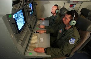
Monitoring the drone’s radar sensors in real time, The Global Hawk Mission Control Element (MCE) are involved, to alter collection in real-time in support battle plans. MCE also provides the data servers to store the MP-RTIP radar data and correlate GMTI detection to form target tracks. Acting upon the information provided by the system, as well as from other intelligence inputs, the combat command nominates targets for battle management nodes to
consider for attack while the battle management command and control (BMC2) directs weapons to attack those targets based on SAR and GMTI cues.”The [Feb. 25] flight successfully demonstrated the interoperability of both platforms to potentially improve and expand surveillance capabilities for deployed forces. “Operators in the Joint STARS aircraft were able to use the Global Hawk as an adjunct sensor,” said Lima. “We were able to display and use the Global Hawk’s radar data on the Joint STARS platform to extend and improve the overall surveillance capabilities and utility of both platforms.” as the GMTI data generated by Global Hawk could be processed by Joint STARS could then be relayed from Joint STARS to the ground forces.

Joint STARS is an airborne battle management and command and control platform that conducts ground surveillance of fixed and moving ground targets to develop an understanding of the enemy situation and support location, tracking, targeting and attack operations. Global Hawk carries a variety of intelligence, surveillance and reconnaissance sensor payloads that allow military commanders to gather imagery and use radar to detect moving or stationary targets on the ground. Capable of flying for more than 30 hours at a time at altitudes up to 60,000 feet, the system also provides airborne communications and information sharing capabilities to military units in harsh environments.
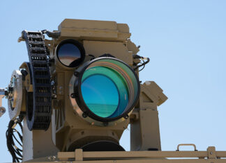
The radar designed for the Block 40 is the AN/ZPY-2 Multi-Platform Radar Technology Insertion Program (MP-RTIP) sensor, which is an advanced air-to-surface-radar for wide area surveillance of fixed and moving targets. MP-RTIP uses an Active Electronically Scanned Array (AESA) to combine Synthetic Aperture Radar and Ground Moving Target detection functions, providing ‘game-changing’ situational awareness and targeting information for warfighters.
Common Imagery Processor Empowers DCGS-I Capabilities
Another integration experiment with DCGS-I the Common Imagery Processor (CIP) disseminated processed Global hawk Block 40 imagery and transferred it to other ground stations via the Distributed Common Ground System – Imagery (DCGS-I) testbed. As the primary sensor processing element of the DCGS-I testbed based in China Lake, Calif., the CIP accepts airborne imagery data, processes it into an exploitable image and then outputs the image to other elements within the testbed. The CIP is the standard image processor used by the U.S. Department of Defense (DOD). The CIP also helps coalition partners to consolidate redundant and stovepiped processing systems.
The CIP’s latest software allowed for the newest synthetic aperture radar (SAR) imagery mode to be processed while simultaneously passing the ground moving target indicator data on to another system for processing. The CIP is the only platform capable of processing concurrent SAR data. Since the year 2000 the CIP has been involved in integration and test activities for many platforms and sensors and was demonstrated in Empire Challenge, an intelligence, surveillance and reconnaissance demonstration that promoted interoperability between U.S. and coalition Distributed Common Ground System assets.
The DCGS-I testbed is used by the DOD to evaluate new intelligence, surveillance and reconnaissance technologies in an operational environment.The testbed has been an active participant in ongoing block upgrades for the Northrop Grumman-developed Global Hawk unmanned aircraft.
Additionally, Northrop Grumman offers the virtualized Common Imagery Processor, also referred to as vCIP, a cost-saving, software-only processing upgrade to the CIP. Already owned by the U.S. government, this architecture allows processing capability to be hosted on a customer’s Linux computer environment and eliminates new hardware costs. Software functionality includes all current sensor processing modes and enhancements already available in the CIP software baseline along with the latest compliance registration afforded by the Joint Interoperability Test Command.
The Air Force operates the Block 40 Global Hawks from Grand Forks Air Force Base, in North Dakota. The Global Hawk and Joint STARS were both built by Northrop Grumman.

