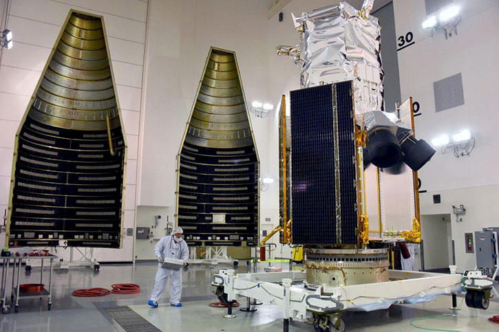
Lockheed Martin has successfully launched today the WorldView-4 commercial remote sensing spacecraft for DigitalGlobe, Inc. An Atlas V 401 blasted off at 10:30 a.m. Pacific Standard Time from Space Launch Complex 3 East, placing the satellite in orbit for customer DigitalGlobe and marking the 137th consecutive successful Atlas launch to date.
The WorldView-4 satellite is the latest in a series of imaging and data satellites for customers around the world. The satellite will capture images so clear that they can distinguish between a sedan, van, and truck from nearly 400 miles in space. DigitalGlobe currently has five satellites in orbit – four Worldview series spacecraft and a single GeoEye satellite.
By leveraging DigitalGlobe’s advanced constellation scheduling system to operate in concert with WorldView-3 , WorldView-4 will more than double DigitalGlobe’s coverage of the world’s highest-resolution 30 cm commercial satellite imagery and increase the rate at which it grows its 16-year library of time-lapse high-resolution imagery.
WorldView-4 orbits Earth every 90 minutes, traveling 17,000 miles per hour and capturing as much as 680,000 square kilometers of the Earth’s surface daily (18 terabytes).
DigitalGlobe, Inc., provides satellite imagery services to the US government and defense services as well as foreign government and commercial customers. The company’s largest customer is the U.S. National Geospatial-Intelligence Agency (NGA) which has recently renewed the Global Enhanced GEOINT Delivery (Global EGD) program under the EnhancedView contract through 2022. Under this contract DigitalGlobe provides on-demand access to global high-resolution commercial satellite imagery. Users can access mission-ready satellite imagery in multiple classification levels via web browser or mobile device, typically within two to four hours after downlink.
Hundreds of thousands of U.S. Government users leverage Global EGD imagery, whether directly or through U.S. Government mobile devices and web portals. The imagery service provides essential mission planning data to warfighters, the intelligence community, and other U.S. Government users. New capabilities to be added to the service include the addition of shortwave infrared imagery (SWIR) and 8-band multi-spectral imagery, e-mail alerts of new collections over a user’s area of interest, and improved archive ordering.
Other products designed for the civilian market include the Basemap Suite that features 1.5 billion square kilometers of high-accuracy, high-resolution imagery – 10 times the land surface area of the Earth. In particular, Basemap +Metro covers over 500 population centers in at 30 cm resolution and 1,700 cities available at 50 cm or better resolution. The company also offers a free imagery servcie online, under the SpaceNet program, an online repository of satellite imagery and labeled training data that will advance the development of machine learning and deep learning algorithms that leverage remote sensing data. SpaceNet is a collaboration between DigitalGlobe, CosmiQ Works, and NVIDIA, and the imagery is now freely available as a public data set on Amazon Web Services, Inc. Spacenet aims to automatically detect and extract features in satellite imagery, fueled by the massive amount of information about our changing planet that DigitalGlobe collects every day, and that of emerging commercial satellite imagery providers.
The WorldView constellation enabled the company to expand its services abroad and the expectation from the WorldView-4 are high. In April and July DigitalGlobe received requests from several foreign governments for satellite capacity commitments from international defense and intelligence customers, seeking high-resolution imagery products from WorldView-4. The company already serves 12 such customers with Direct Access Program customers.
Today’s mission was launched by the United Launch Alliance (ULA) aboard an Atlas V 401 configuration vehicle, which includes a 4-meter-diameter large payload fairing. The Atlas booster for this mission was powered by the RD AMROSS RD-180 engine and the Centaur upper stage was powered by the Aerojet Rocketdyne RL10C engine.