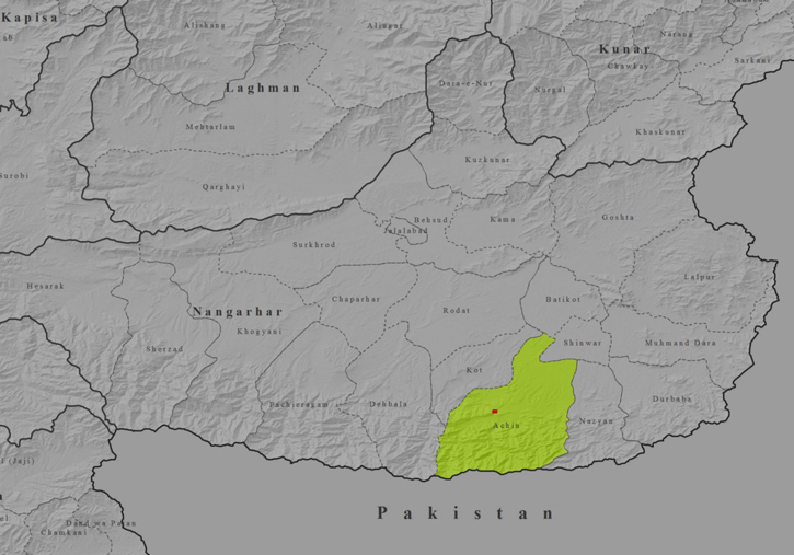
There has been intense media coverage of the US Military’s Massive Ordnance Air Blast (MOAB) strike on April 13, 2017 in Nangarhar, Afghanistan. On the 15th April, Afghanistan’s defense ministry reported the death of 94 militants including 4 major commanders and that no civilians had been killed in the strike. Two civilian deaths were also reported. As ISIS was reluctant to report the actual damage on site, no evidence surfaced from Nangarhar for weeks, until recently, despite nearly 100 fatalities Daesh suffered in the attack.
Satellite imagery obtained 15 hours after the attack provided some data for assessment of the damage, as Afghan authorities access to the site has been restricted by the US Military. The first video evidence from the site was recently released by theAfghan police sheds some light on the devastation that resulted from the GBU-43/B MOA) attack.
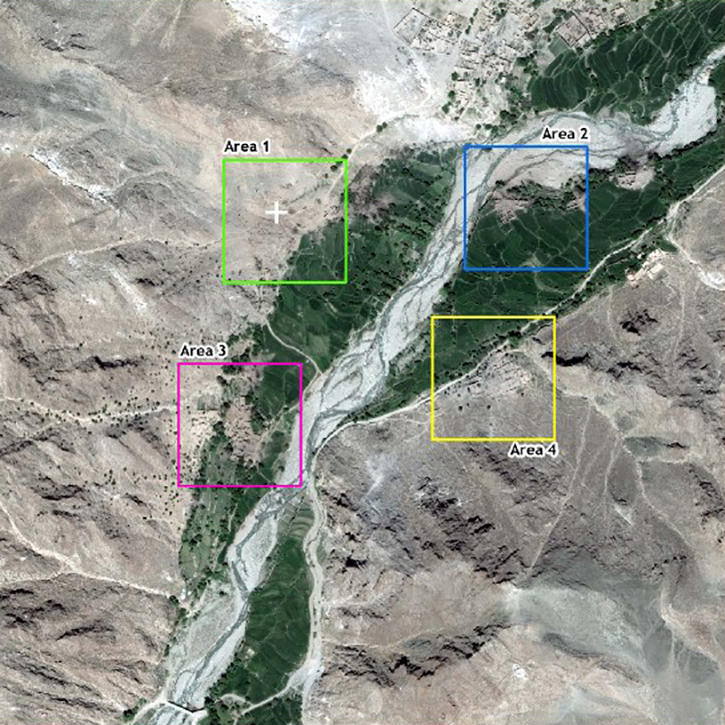
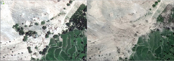
The overall picture of destruction is varied. In the immediate area around the impact point, (marked as Area 1 in the satellite image), no buildings or structures remain standing and many of the trees and vegetation are destroyed. Analysis of the point of impact can determine little in the way of a crater, despite some media reports suggesting that the crater left by the blast would be more than 300 meters wide. Areas marked 2, 3 and 4 in the image exhibit signs of destruction to buildings, with some roofs destroyed, but large numbers of buildings remain apparently undamaged.
Post-strike satellite imagery shows that although the blast did not create a significant crater on the ground, the destruction was absolute of approximately 20 compounds and trees, 650 meters to the southwest of the center of the village of Asadkhel and close to the villages of Tangai and Lansai Ahmad and 3 kilometers from Shadal Bazaar. There are signs of destruction to agriculture and trees in the immediate vicinity of the blast. Damage to compounds and buildings can be observed further from the blast site but it is not clear whether this damage was caused by this particular attack.
It is understood that the MOAB weapon explodes approximately six feet above the ground and propels its flame and shock waves horizontally, rather than vertically. The effect is to knock over trees, buildings and other infrastructure, collapse cave entrances and underground facilities and kill, maim or demoralize enemy combatants. Reports indicate that the blast has an effective range of approximately one kilometer. The attack was aimed to destroy tunnels and caves used by Daesh Khorasan militants that operate in the area.