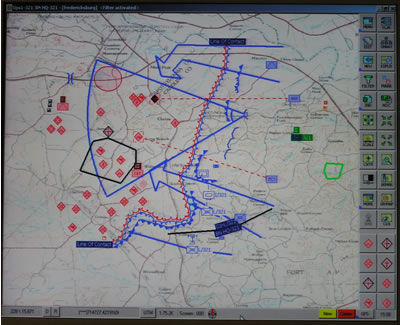
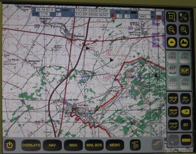
Together, intelligence data and Blue Forces Tracking are fused to generate the digital map based Common Operational Picture (COP), which replaces traditional paper-based situational maps used for many generations. COP provides full and realistic presentation of all players – both hostile and friendly, refreshed in near-real-time updates. The situational picture presents all elements with precise locations, generated by reported GPS coordinates received from each element. Targets, enemy activity and order of battle are depicted in specific or generalized symbols, prepared by Brigade intelligence, and fused with information received from higher echelons. Cartographic presentations are also provided for logistical, service and combat support elements, utilizing their specific information systems, planning and reporting.
This feature continues to cover the following topics:
- Tactical C4 Networking Challenges
- Building Blocks of C4 Systems
- Vehicular C4 Applications
- C4 for the Battalion Level
- Situation Assessment Tools For Dismounted Leaders
- Brigade’s Tactical Operations Center
- Common Operation Picture (COP)
- The Modern Command post
- C4 Networking Architecture
- Mission planning Tools

