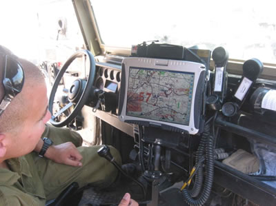
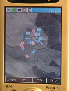
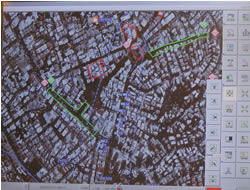
 Advanced wireless communications integrated with command, control and computer systems are combined with the IDF new Tactical Operational Command and Control Headquarters system (TORC2H) deployed by the for border security was integrated by Elbit Systems, unifying sensors, security forces and command centers into the regional security C2 system. The system utilizes C2 and GIS software tools provided by ARCNet, to facilitate direct wireless communications, over ToughBook PCs and PDAs, sharing situational picture and rapidly transferring reports and decisions between commanders in Command Post and in the filed, to and from forward elements. between sensors and field units. Geographical Information Systems (GIS) displayed relevant data with geographical features, over 3D or 2D digital maps. It also supports virtual presentation of the target and situation, as viewed by each of the different forces. TORC2H uses vehicular mounted as well as dismounted, units, facilitating continuous monitoring of situations via sensors images, visualization of unit deployment, location and status, rapid and transparent messaging of command, reports and situational reports, etc. The system was selected by the IDF for border protection command and control and is deployed along the lines separating the Israeli and Palestinian authority controlled area.
Stand-alone command, control, communications, computers and intelligence (C4I) network developed by Ness technologies is already deployed by Special Operations units, including the Israel Navy Special Forces (Naval Commandos). The system is an adaptation of Ness technologies’ Ness Control system running on laptop PCs and PDAs enabling teams to prepare, distribute and receive live videos, images and digital maps from sensors, and between the network’s PCs. The system utilizes various types of communication links including tactical HF/VHF radio, WiFi (IEEE 802.3 – IEEE 802.5), wireless LAN/WAN, cellular and Ethernet. Future evolution could migrate to include evolving commercial high speed networking standards including WiMAX (IEEE 802.16).
The use of distributed databases, powerful geographical information, and 2D / 3D presentation systems enable commanders to make decisions based on updated situational assessment. In addition to its basic functions, the system provides real time monitoring of force positions and movements, improving coordination among neighboring forces.

