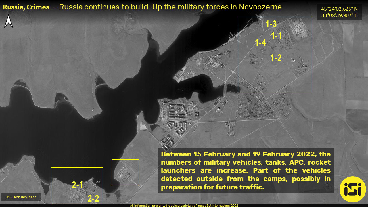
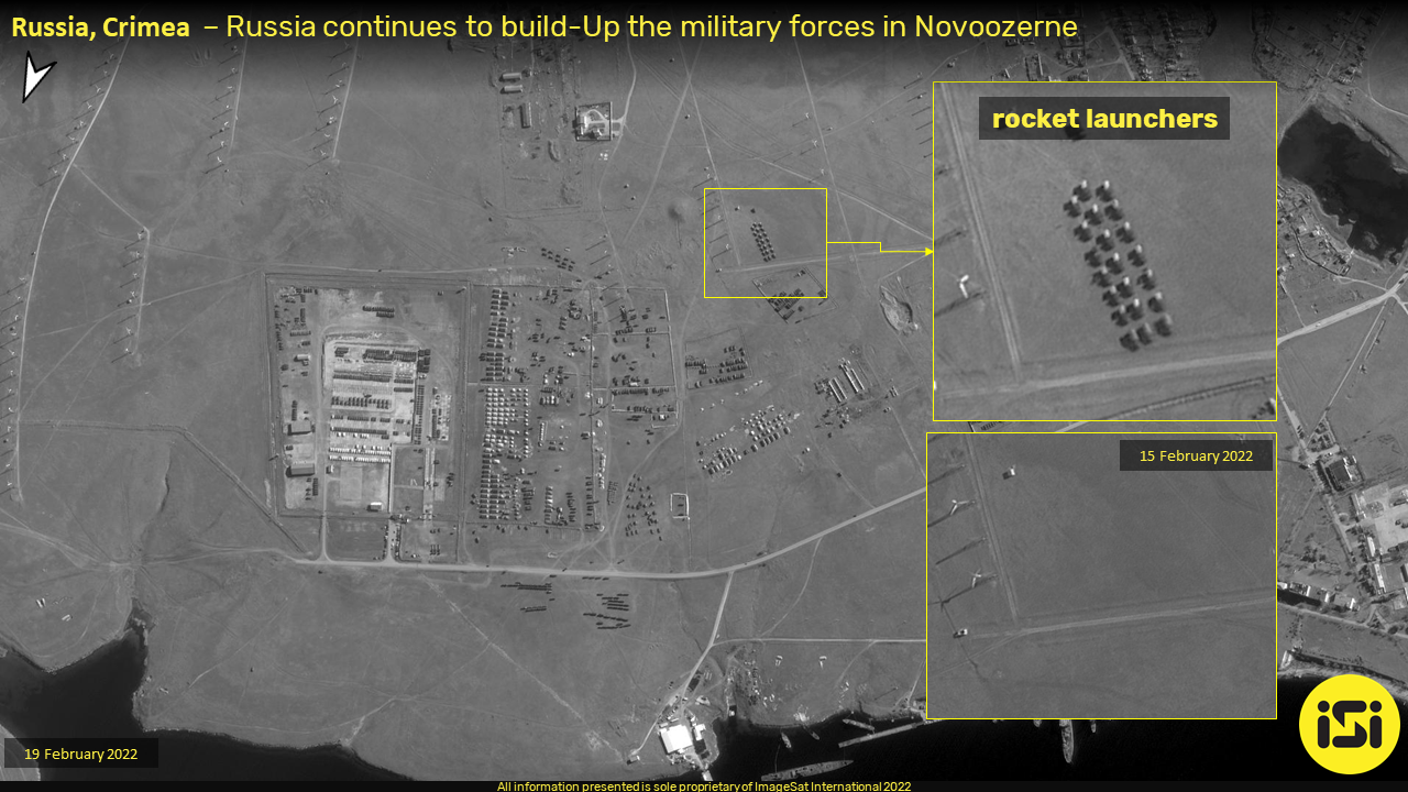
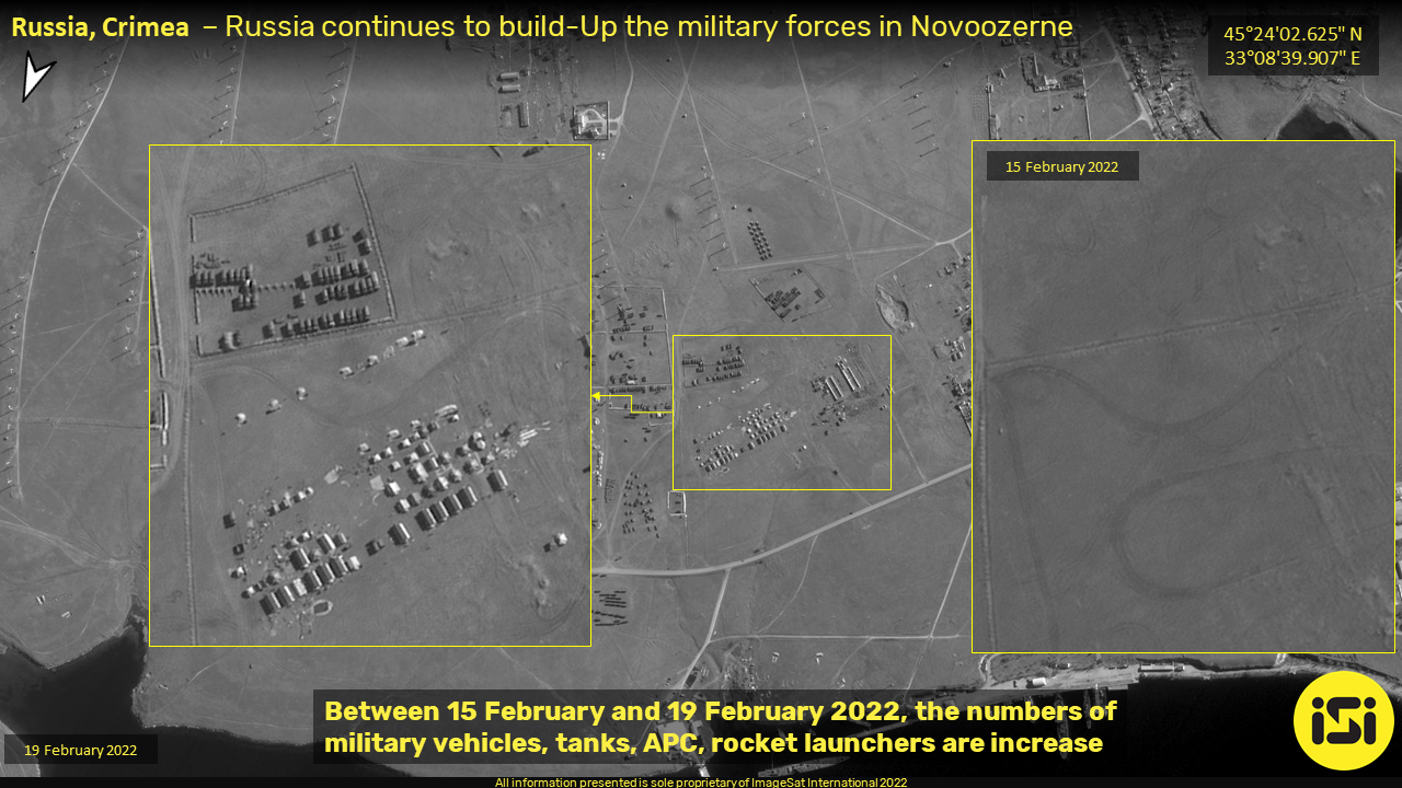
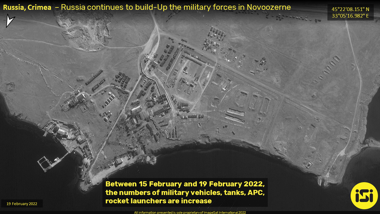
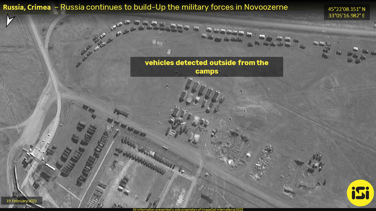
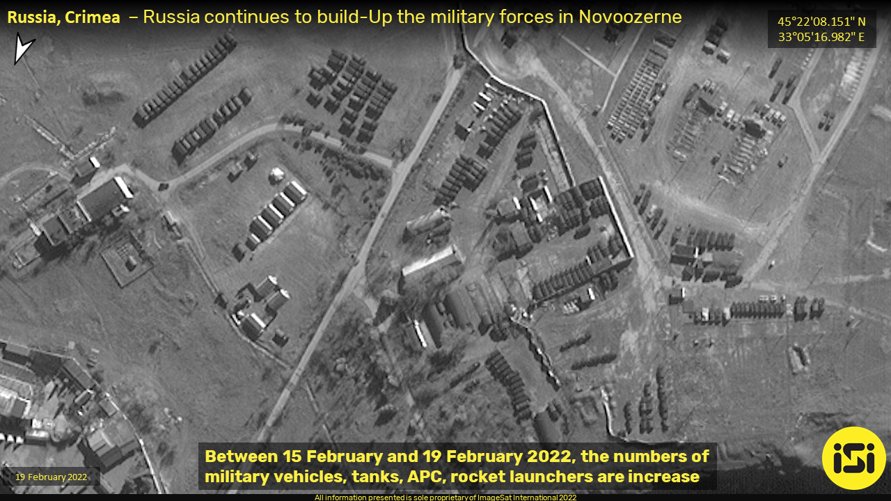
The following satellite images (19 February 2022) were taken by the ImageSat International Eros reconnaissance satellite. Despite the Russian MOD announcement on 15 February of units moving out of the peninsula, the 19 February shots show a continued buildup of Russian military forces in Crimea. The satellite images show military concentrations in built-up and open areas around the township of Novoozerne on the western side of the Crimea peninsula.
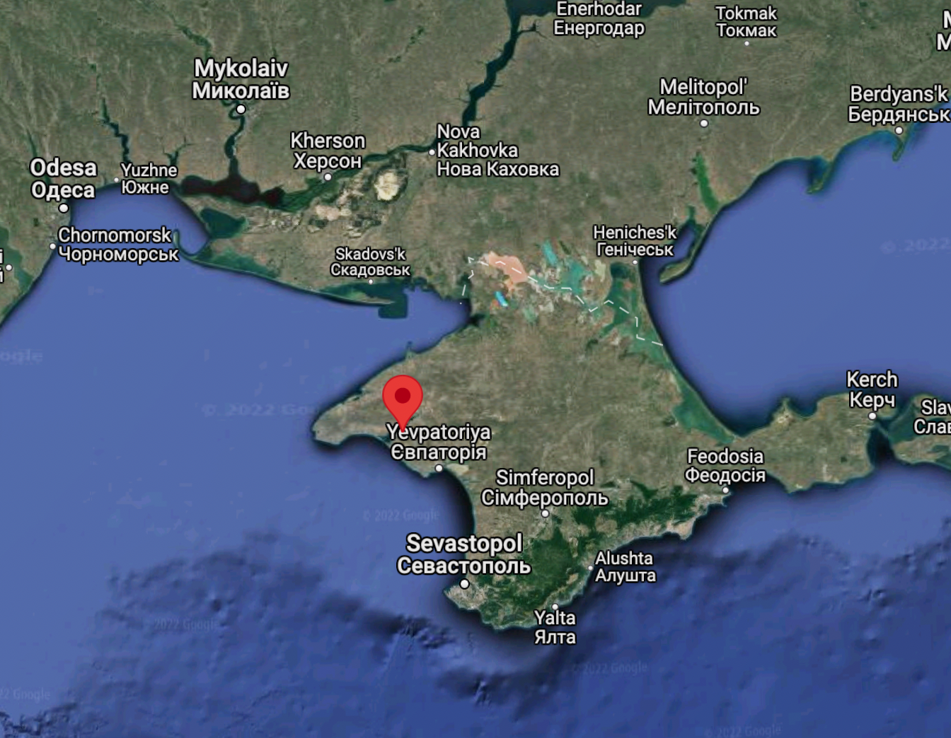
Russian forces buildup in Novoozerne, Crimea, as shown in satellite photos taken 19 February 2022. by Imagesat International (ISI) Eros satellites. Source ISIThe Crimea peninsula and Southern Ukraine. Source: Google earthArea 1-1: Forces concentrations showing part of the units moving out of the staging area and grouped two columns in marching formation (lower right side).Area 1-2: Another unit of rocket launchers is staged in a three-line formation ready for marching. On the 15th, this area was empty. This unit is located south of the staging area shown on Area 1-1. Source ISIArea 1-3: Another unit, possibly a mechanized battalion, moves into a marching formation northwest of the staging area (Area-1). The image on the right shows the same area on 15 February 2022 – empty vehicles. Source ISIArea 1-4: Another unit newly arrived at the empty area just four days ago. Source ISIArea 2 – Other forces are concentrated in another part of Novoozerne, Crimea. Source ISIArea 2-1: Another image shows the deployment of a sizeable mechanized formation outside the staging area, positioned in marching order. Source ISIArea 2-2: Russian units that have recently arrived in this staging area, this satellite image shows vehicles parked adjacent to a logistic area, north to the unit preparing to march, shown on Area 2-1. Source ISI
Visiting the UMEX & SimTEX 2026 exhibition taking place at the ADNEC Centre in Abu Dhabi this week, a new system caught our attention. Slovenian company Carboteh has introduced an unconventional approach to protecting...
The opening week of 2026 has been defined by a singular, paradigmatic shift in modern warfare: the "catastrophic failure" of Venezuela's integrated air defense network during a U.S. special operation. The operation succeeded not through brute force, but by rendering Venezuela's Russian S-300VM and Chinese "anti-stealth" radars effectively blind, validating the supremacy of advanced electronic warfare over legacy kinetic defenses. This failure has sent shockwaves through the global defense market, underscoring why nations like Spain and Germany are rushing to modernize their air defense architectures with Western alternatives, while massive procurement programs exceeding $301 billion signal an accelerated transformation toward unmanned systems, directed energy weapons, and indigenous production capabilities.
Turkey's defense industry transformation extends far beyond its celebrated drones. Now ranking 11th globally in defense exports, Turkey is executing a comprehensive strategy to become a top-tier arms supplier. With 75% of exports flowing to Western markets and five firms in Defense News' Top 100, Turkey is methodically building a complete defense ecosystem through combat-proven systems, integrated defense diplomacy, strategic self-reliance, and real-world R&D in active conflict zones.
Lockheed Martin Skunk Works® and XTEND have achieved a major milestone in JADC2 by integrating the XOS operating system with the MDCX™ autonomy platform. This technical breakthrough enables a single operator to simultaneously command multiple drone classes, eliminating the friction of mission handoffs. From "marsupial" drone deployments to operating in GPS-denied environments, explore how this collaboration is abbreviating the data-to-decision timeline and redefining autonomous mission execution.
As traditional defense primes face mounting competition from agile “neoprimes” such as Anduril, Palantir and Helsing, the balance of innovation is shifting toward software-defined warfare and scalable, dual-use technologies, while global industry consolidation—marked by Boeing’s integration of Spirit AeroSystems and other strategic mergers—signals an intensified race to secure control over the defense technology value chain. Our Defense-Tech weekly report highlights these trends.
In early October 2025, a coordinated wave of unmanned aerial system (UAS) incursions—widely attributed to Russia—targeted critical infrastructure across at least ten European nations. The unprecedented campaign exposed the fragility of Europe’s air defenses...
Executive Summary
The past week (September 18-25, 2025) represents an inflection point where strategic defense concepts have transitioned from doctrine to tangible reality. An analysis of global events reveals four primary, interconnected trends shaping an...