DTACT provides mission planning and rehearsal tools designed specifically to illustrate urban terrain. The system utilizes an integrated network of wireless communications units attached to each member of the combat team, computer terminals and PDAs at leaders and command levels, and integrated visualization and battle management tools designed to control, evaluate and debrief training exercises and operations.
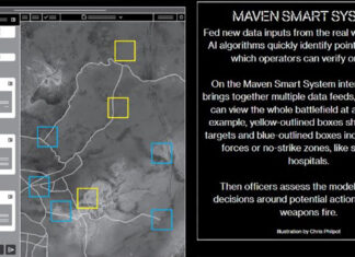
The system uses an integrated tactical presentation showing the tactical plan and positions of each team member on aerial photos or maps, a tree-shaped ORBAT chart showing the status of each combatant, a reference map showing the combat zone relative to the surrounding area, and the battle time progress shown in gant graph view, which compares planning to actual execution of operations.
Software 3D visualization features include multiple angle visualization, line of sight calculation, location optimization for observation posts, firing positions and sensor, planning axis of advance generating video simulation of selected routes. Other features include determination of boundary lines, safety limits etc. A comprehensive Exercise Manager capable to plan, monitor and control any exercise. DTACT Exercise Manager supports the blue and red forces with cellular based communications, wireless LAN or any other form of communications capable of high data rate for transferring images and video. All participants use PDAs with GPS which monitor the exercise and track force location, status and actions. After Action review (AAR) are continuously recorded, with all messages, audio and video used. The system can interface with helicopters and ground sensors as well as other training aids such as MILES systems


