

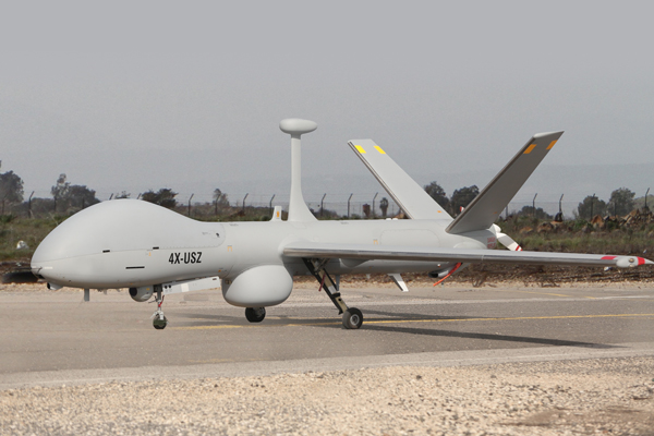
Elbit Systems is launching a maritime configuration of its Hermes 900 medium altitude long endurance drone, aiming at the growing demand for UAS in maritime missions worldwide, and particularly in Asia. The company is unveiling the new configuration at the Aero India 2013 event in Bangalore this week.

Maritime surveillance and patrol capabilities are specifically important in recent years, as countries are required to cover growing maritime areas claimed by the Economical Exclusion Zones (EEZ) that span up to 200 nautical miles from their coastline or farthest island. In the case of India, for example, such area covers a huge expanse of the Indian Ocean, bordering Indonesia in the east to Somalia in the west. A country cannot cover such vast space from its coastal radar stations, nor can it commit manned patrol flights to cover the entire area.

The Hermes 900 maritime configuration launched at Aero-India 2013 can carry payloads of up to 350 kg, including maritime surveillance radar, Automatic Identification System (AIS), an electro-optical multi-sensor payload and electronic surveillance systems. The radar being tested on the Hermes 900 is the SELEX Galileo’s Gabbiano T200, supporting surface search, inverse SAR (ISAR), high resolution synthetic aperture radar and ground moving target indication modes. According to Ofer Ber-Dov, VP Marketing & Business Development at the company’s Unmanned Systems Division, the Maritime Hermes 900 has the endurance to cover vast ocean areas, it is equipped with redundant line-of-sight and satellite communications links and radio relay, enabling the operator to ‘talk through’ to vessels at sea. “The aerodynamic efficiency of the Hermes 900 enables the operators to perform frequent changes in flight profiles, to enable visual identification of vessels at sea in addition to the classification of vessels based on their Inverse SAR (ISAR) signature, provided by the radar.” Satellite communication enables it to fly to mission areas at extended ranges as far as 1000 nautical miles from shore. The redundancy in datalinks enables the control of two UAS simultaneously from a single ground control station. This has a significant effect on the assets, manpower and operating cost, as well as in improving the efficient utilization of UAS that can now cover more area or run a denser surveillance over a given area.
The entire command and control (C2) is located in a single shelter, which can be operated on shore in a mobile shelter base or indoor configurations at sea or co-located in several locations. Elbit Systems’ C2 system has been integrated into the Maritime Hermes 900 Ground Control Shelter, supporting specific mission planning applications such as maritime search, anti-submarine missions or search and rescue. To further improve the efficiency of the country’s EEZ, particularly nations with large maritime territories, Elbit Systems has teamed with Windward Ltd., integrating the WindWard’s satellite-based maritime intelligence analytic system into the Hermes 900 maritime C2 system. As a global information system, MarInt covers any area of interest, assisting in tracking maritime traffic, detecting illegal fishery monitoring, and effectively managing port traffic. The system performs deep behavior analysis on each ship in its footprint, searching for irregularities and discrepancies from routine activities. Vessel behavior is analyzed to detect anomalous and suspicious behavior, which differs from routine maritime patterns, and could indicate to illicit activities. “Such analysis can reveal areas of suspicious activity, pinpointing patrols to specific vessels showing certain anomalous behavior” Ben-Dov added, “such information enables operators to task unmanned assets to patrol those designated areas, identify and track the suspicious vessels, thus significantly optimize the aerial patrol and increase mission effectiveness while reducing cost.”


