Tag: satellite imagery
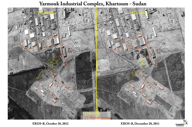
Was The Alleged Attack on Sudan Prelude to Iran?
A powerful explosion at the Yarmuk military factory rocked Sudan's capital before dawn, sending detonating ammunition flying through the air and causing panic, the...
Teledyne to Develop Space-Based Digital Imaging Capability
Teledyne Technologies Incorporated (NYSE:TDY) announced today that its subsidiary, Teledyne Brown Engineering, Inc., in Huntsville, Ala., was awarded a Cooperative Agreement by the National...
Post strike Battle Damage Assessment – Lybia , April 2011
Post strike Battle Damage Assessment (BDA) views taken after NATO attacks at the Libyan Air Force base at Miserata, prior to the rebels takeover...
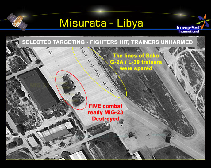
NATO attacks at Misrata Airbase
Post strike Battle Damage Assessment (BDA) views taken after NATO attacks at the Libyan Air Force base at Miserata, prior to the rebels takeover...
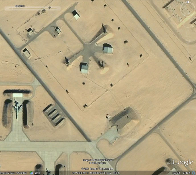
NATO Strikes at Libyan Air Defense Sites
March 25 - April 19, 2011 As seen by satellite photos, The Libyan Airbase at Al Jufra remains dormant for years, as aircraft suc as...
Russian New Military Satellite Lost in Space
The Russian military has lost contact with a satellite launched from the Plesetsk spaceport earlier today. According to state-owned Khrunichev, the satellite's launcher manufacturer,...
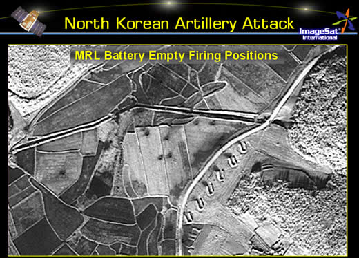
North Korean ‘smoking gun’ spotted: Rocket Launchers in Positions aimed at...
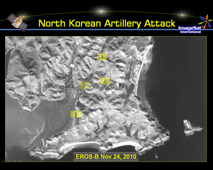
North Korea fired scores of artillery rockets at the South Korean Yeonpyeong island on November 23, 2010, killing two soldiers. Two soldiers and two civilians were...
Israeli Satellite Images Locate North Korean ‘smoking gun’: Rocket Launchers in...
North Korea fired scores of artillery rockets at the South Korean Yeonpyeong island on November 23, 2010, killing two soldiers. Two soldiers and two civilians were...
North Korea Accelerates Nuclear Plans
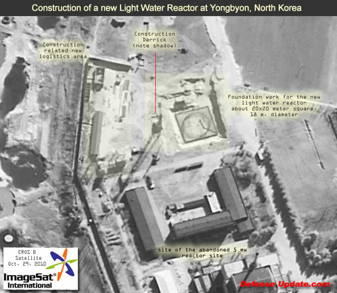
Reveal Construction Of Light Water Reactor, Uranium Enrichment Facilities At Yongbyon The scope of the North Korean nuclear program is much larger than previously estimated...
Massive Construction Visible at Iran’s Missile & Space Center at Semnan
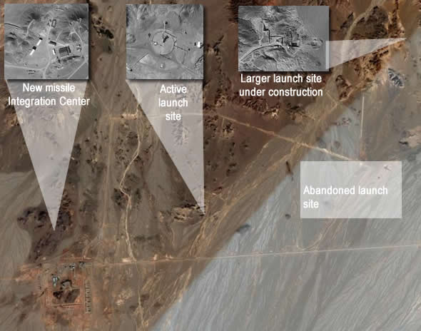
Extensive infrastructure developments are evident in the following satellite imagery, obtained by the Israeli Eros-B satellite. The images are superimposed on an earlier image, available through...
Distributed Common Ground System (DCGS)
The DCGS mission is to collect and process vast amounts of intelligence and imagery from manned and unmanned reconnaissance sources. The U.S. Air Force has...
EROS A Satellite Payload
EROS provides an important insight into the Israeli space imaging capability. According to ElOp, the camera currently deployed on Eros A is operating at...