Saturday, May 4, 2024
More
    Home Blog Page 423

    EO Payloads – Comparison

    Full Size Systems

    SAR Payloads – List

    Convoy Protection and IED Patrols

    Start < Page 6 of 6 >

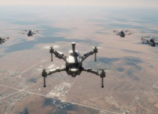
    Patrolling highways in hostile area, while protecting convoys is part of the regular mission of UAVs in Iraq. Relying on continuous communications and positioning from blue force tracking systems, UAVs can cover a convoy, controlled from ground control stations at distances of up to 100 km. However, a more suitable solution is to use a small UAV loitering overhead, equipped with ground surveillance systems to monitor the area ahead of the convoy forewarn ambushes or suspected IEDs lying ahead. Such systems were demonstrated by several manufacturers at the UAV Battlelabs. One of the system, the Boeing/Insitu ScanEagle unmanned aerial vehicle (UAV) could be used for convoy protection in Iraq before the end of 2005.

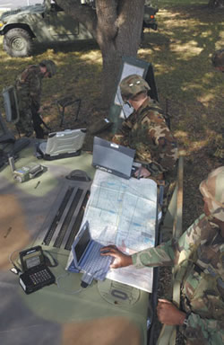
    New sensor suits are evaluated for these missions, providing situational awareness and early warning of hostile intent. Such sensors are including close coverage by acoustic gunshot detectors, such as the ShotSpotter, which automatically slews the UAV’s camera to source of fire; EO/IR imaging sensors offer coverage at longer range, and enable the UAV to fly ahead of the convoy, providing early warning about potential threats. Synthetic aperture radar can also employed by “sweeping” roadsides from long distance, detecting changes in the terrain, which could indicate IED locations. To better coordinate between the UAV and the convoy, the UAV or its sensor has to be controlled from the moving vehicles, providing continuous feed of video imagery while on the move. The UAV can perform several tasks automatically, including Continuous Change Detection (CCD) processing and moving target detection. Advanced operating modes enable the UAV to autonomously maintain a fixed distance ahead of a convoy, by following the route and GPS location of the ground station (security team).

    Additional parts of this article:

    Automatic Change Detection

    Start < Page 5 of 6 >

    An important feature of image processing is the comparison of new and stored images to detect changes over time. This method is called Coherent Change Detection (CCD) and its uses are rapidly spreading throughout the military. By comparing live images with past images of the same area, systems can automatically detect and identify changes which can show placement of new objects such as hidden IEDs, faint signatures of recent movement, such as vehicle tracks, changes in foliage indicating human movements, or application of camouflage that could indicate suspicious activity. Through the image analysis and investigative process, these views can be superimposed with thermal images, showing latent signatures of recent human activity. When searching for a specific type of object, hyperspectral analysis can be performed, by dedicated sensors, which are designed to identify specific traces of chemical or organic materials, by their distinctive spectral reflections.

    Multi-spectral image fusing is also performed to enable target identification from very long range, particularly at night. For example, combining Near IR (NIR) with TV overcomes the visual reflection from a car windshield, to show people inside a car. Identifying these people from a long distance can be done by illuminating the target with an invisible laser beam, and using a special telescopic “gated CCD” sensor to view the target in great details.

    Progress is also evident in solving the “bandwidth bottleneck”, transferring large files over communications networks. The US Marine Corps are planning to field the Video Storage Wide Area Network, which collects and provides information on situational awareness. The network uses multiple image collectors including Pioneer and ScanEagle UAVs. The ground stations of these UAVs are streaming live video over satellite communications to a central repository which provides digitization, compression, editing and storage services. These video databases are then made available to multiple users in theater as well as worldwide. While the system supports multiple users and multiple streams, bandwidth availability becomes an issue when 128K “pipes” are used – typical streaming video requires around 400-Kbps bandwidth, which is not always available for field users.

    Additional parts of this article:

    Computer Mapping & Modeling

    Start < Page 4 of 6 >

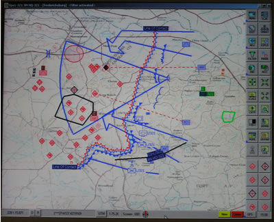
    For hundreds of years, maps and cartography provided critical means for command and decision support. Their value was derived from the accuracy, timeliness and relevance of their data sets. Maps are still valuable command tools, but today their production is faster, the data is much more accurate and most important – when embedded into digital processing and presentation environment, they provide a common denominator for command and control. With new technology geographical information systems (GIS) are used to process sensor information; generate spatial presentation of intelligence products.

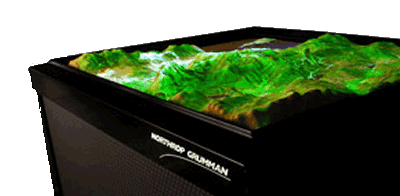
    Geospatial products are also used for presentation of terrain measurement data, as input from SAR, LIDAR and LADAR sensors is processed and represented as realistic 3D models, used for operational planning. Rectified over a common grid, ISR data can automatically update a situational picture, or further process it with satellite or aerial imagery presenting realistic 3D models of an area, including updated man-made features. Such models are used for mission planning and rehearsal, briefing on a synthetic “sand-box”, spatial orientation and training.

    Geo-registration is an essential capability for advanced image processing. Images are referenced to a common geographical grid enabling detailed comparison between different views of the same area. In the past, such referencing was done in a manual, a time consuming process prone to human errors. Today, geo-registration automation is done in a real-time process, performed on still images, including SAR and GMTI, and most recently on live video. This capability enables endless ways to manipulate the images, by merging them into wide-area mosaics, morphing them to suite the proportions of 3D models, correcting optical and perspective distortions etc. Accurately registered into a common grid, images are fused into common views, providing stereoscopic views (depicting height and depth of objects) and true, dynamic 3D computer generated models and “fly through”, which can be generated in few hours, rather than weeks, offering realistic views of an object from different angles.

    Additional parts of this article:

    Enhanced Vision Systems

    Start < Page 2 of 6 >

    By using state of the art technology, much of the information can be shared, fused and used to improve the final product. For example, scanning a wide area for time critical targets cannot rely only on EO means alone. By merging GMTI and Stripmap SAR images, wide areas can be scanned rapidly for moving targets, man-made objects and potential targets. Such elements can be anything from a pick-up truck to a transportable missile launcher. When potential targets are detected, Spot mode is used to automatically scan through each location in an attempt to distinguish differently shaped targets such as a specific type of tank or truck. Known targets can be tagged by their distinct signature, or actively marked for automatic detection and tracking. SAR imagery is sufficient for identification of military targets, identifying the distinctive 3D signatures and object shapes of specific vehicle types; further investigation of the target is required for engagement of typical targets in asymmetric warfare.

    EO sensors are employed to further examine specific locations or suspicious objects detected by the radar. By fusing SAR, IIR, thermal and EO images, analysts can now focus on the potential “needles”, which automatic processes have weeded out of the larger “haystack”.

    As all data is geo-referenced, target coordinates can be extracted immediately for rapid response. The fusion of signals from different spectral bands enable better visualization of information which could be not be seen in by visible means. The US Air Force pursues several Foliage Penetrating (FOPEN) concepts, including processing of hyperspectral sensor data, for collection, location, and identification of camouflaged and concealed targets and foliage penetrating SAR.

    Additional parts of this article:

    Turning Raw Data Into Actionable Intelligence

    Start < Page 1 of 6 >

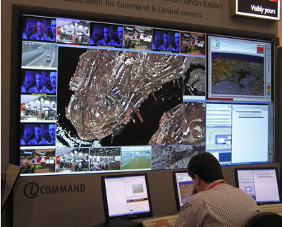
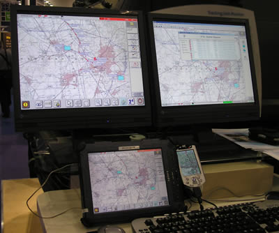
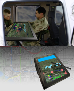
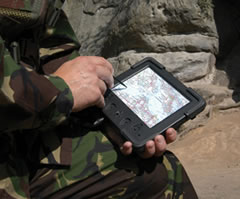
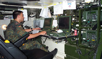
    UAV and their sensors are only part of the Intelligence, Surveillance and Reconnaissance (ISR) “big picture”. Completing that concerns processing, storing and retrieving the data into actionable intelligence. Utilizing modern commercial off the shelf (COTS) technology, sensor data can be rapidly processed. Correlated to geographical grid, and merged with live and stored images, imagery and spatial information including EO, SAR, MTI maps, SIGINT and ESM can be fused and presented over common map display, showing a detailed and accurate multi-dimensional situational picture. The use of ISR products is not limited to intelligence analysts, but can also be used by warfighters in the field, using tactical computer terminals and PDAs. Prior to delivery products are trimmed, wrapped, and compressed to adapt to narrow-band wireless communications.

    Presently, “stovepipe” systems are employed to provide intelligence. These include various airborne and ground based sensors, such as Global Hawk and Predator UAVs, Joint STARS ground surveillance systems and various ELINT/COMINT assets. Each system is operated separately, utilizing specific sensors, airborne and ground based processing and exploitation systems. The refined intelligence is shared at a higher level, where it supports operational planning and ongoing operations.

    Additional parts of this article:

    Counter-Sniper Systems

    Engaging snipers is another LIC priority. RAFAEL is unveiling the Spotlite sniper detection, location and engagement system. The system comprises a FLIR, CCD with continuous zoom, a Laser Range Finder, and GPS position location system. The Spotlite can be linked with multiple “subscribers” – either snipers or other countermeasures of weapon systems. Spotlite operators can analyze fire sources and verify that a specific source is actually hostile fire. Once verified, the image of the hostile fire position is captured, and transferred to snipers or other support units, which can engage the target with direct or indirect fire. The Spotlite system is currently operational. It was designed for use by observation and reconnaissance forces, sniper units and Special Forces as well as for the protection of static posts under enemy threat.

    Elbit systems displayed the active gated imaging day/night sight, attached to a sniper sight. The system can operate passively or with laser illumination, enabling snipers and observers to get high definition images from extended range, including recognizing face images through glass windows or vehicle’s windshield, reading license plate numbers from long distance, in day and night. It also enables effective operation in urban area, in both day and night where adverse lighting conditions can limit operations with other devices. As the system is immune to lighting sources, it cannot be blinded (virtually canceling the blooming effect).

    Start – Previous < page 10 out of 10 >

    Mobility Denial

    Start < Page 8 of 9 >

    Car-bombs have demonstrated their deadly effects in many attacks against military and civilian targets in many countries. While a single suicide bomber can carry a 10 – 15kg of explosives, that will create a deadly attack against unprotected people, car bombs can carry several tons of explosives, which can be devastating against large buildings. Therefore, controlling and denying mobility in the vicinity of the potential target is of critical importance. Road blocks have evolved to meet the new challenges of suicide attacks. Modern road blocks are designed to be transportable, deploy rapidly and absorb high energy to stop heavier vehicles at higher speeds.

    X-Net, designed by Qinetiq is a portable net constructed from super-strong dyneema polyethylene, with spikes positioned along its leading edge. X-Net is capable of bringing a vehicle to a complete standstill within 75 meters. X-Net can be used to secure checkpoints and deny traffic at secured areas, as well as on pursuit of suspicious vehicles, where opening fire is not an option. A different system is offered by General Dynamics – the Portable Vehicle Arresting Barrier comprised of a rapidly erecting net (erected within two seconds). The net wraps around the target’s wheels, bringing it to a stop within a distance of 35 meters. The system is designed to stop up to 7 ton vehicles at a speed of 45 mph. Much simpler but highly effective barrier is the Modular Vehicle Barrier (MVB) offered by Mifram. This lightweight steel structure is quickly assembled into a highly effective barrier, which stops a vehicle on the spot, with zero penetration for any sized ramming vehicle. Other devices are using high power microwave to disrupt vehicle electrical or electronic systems.

    Additional parts of this article:

    Vehicle Protection Systems

    Other aspects of LIC are the modification and adaptation of vehicles, primarily armored vehicles, to cope with the threats posed by urban guerilla. A new system officially unveiled here for the first time is the Trophy Atcive Protection System, developed by RAFAEL (weapon system) and IAI/Elta (sensor). Trophy uses distributed sensors which detect and localize the incoming anti-tank missiles, RPG etc. When a threat is detected coming within range, the system fires an explosive countermeasure fragmentation charge which hits and destroys the threat before it reaches the protected vehicle.

    Trophy is designed to equip armored fighting vehicles, and one of the first platforms which will be fitted on is the new Merkava Mk 4 main battle tank. It was demonstrated at the exhibition in two configurations. One was mounted as an integral element of a modified Merkava Mk 3 tank, while a lighter version was displayed as an add-on element, installed on a Stryker armored vehicle.

    Elisra announced at LIC a new derivative of its PAWS IR missile warning system used on helicopters and aircraft. The new sensor designated TANDIR will be using a passive warning system for combat vehicles, an essential element for future lightweight active protection systems. As in the airborne installations, TANDIR will provide full hemispherical coverage enabling detection and tracking of multiple simultaneous threats. As an imaging IR sensor it will contribute to the platform’s situational awareness and threat assessment capability.

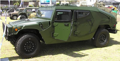
    Protection of light vehicles is the specialty of Plasan Sasa. At LIC-2005 Plasan demonstrated two of its most recent designs, the armored MTVR, developed for Oshkosh for the US Marines, and a new version of up-armored communications version of the Humvee, developed for the Greek Army.

    < page 7 out of 10 > Start – Previous –  Next

    Protection of Vehicles and Fixed Positions

    Start < Page 7 of 9 >

    Vehicle armoring has been a major concern for many armies, which participate in the war on terror and specifically the conflicts in Afghanistan and Iraq. These armies are utilizing various means of protection, including conventional armor plating for heavy vehicles (such as trucks and engineering vehicles). Lightweight vehicles require more advanced, lightweight armor to protect against small arms fire, improvised explosive devices (IED), mines and RPGs. Effective countermeasures against the later requires heavier or reactive armor, or special active protection systems which are currently under development.

    Protection of static positions such as checkpoints, observation posts, and inspection sites presents a major challenge. In these applications, specially designed pre-fabricated structures can be used, where advanced materials are employed to minimize the risk of attack without degrading the effectiveness and performance of the facility. Such structures can be constructed from a combination of reinforced concrete, steel, composite materials, and blast mitigation structures. Examples of such structures are BAM-1A wall panels, which can be used for add-on protection for existing buildings. The material offers various levels of anti-ballistic protection, blast and forced entry protection. BAM is manufactured by ASAP Inc. Protected positions can also be constructed from Rapid Armored Shelter System (RASS), or Personel Balistic Shield produced by Plasan Sasa, which can be used as a personal shield by an individual soldier, or, when combined together – as a protection of a forward medical point, machine gun firing post, or even makeshift protection for an unarmored vehicle.

    A different method of rapid deployment force protection is utilized by the German Army – which will soon field container sized protected structures produced by EADS, which are designed to support German Army out-of-area deployments on peacekeeping missions. IBD from Germany is developing a mobile version of a protected container, which uses the company’s advanced AMAP composite armor, formed into a cylindrical, sealed and highly protected compartment in which troops, medical teams or sensitive supplies such as explosives or ammunition can be transported through hot zones, in relative safety.

    Prefabricated armored structures offer augmented protection for fixed and vulnerable facilities, such as checkpoints, observation posts and guards positions etc. Such structures use blast mitigation structures, as well as steel meshes, to activate RPGs and AT missiles before they strike the surface. When weight is a consideration, composite armor can also be used. When the threat of anti-tank missiles is high, IR countermeasures can be applied selectively – including laser dazzlers, infrared countermeasures etc.

    Additional parts of this article:

    Integrated Infantry Combat Systems

    This trend has been implemented with infantry combat systems. Various soldier’s integrated systems are under development by Elbit Systems and ITL. Among such systems, on display at LIC-2005 are the AISS integrated combat system developed by ITL, the MPRS integrated, small-arms fire control sight system, and multi-purpose weapon system (Refaim MPRS) developed by IMI. This system has gone through extensive development and testing in the recent year, with three types of ammunition – enhanced direct attack weapon, utilizing proximity fused fragmentation grenade, a non-lethal grenade, and an observation grenade, which can be fired over the target area and transmit real-time images throughout its flight. A different system, developed by RAFAEL is the Firefly, a 145 gr. grenade designed to be launched from 40mm launchers (such as the M-203). The projectile is equipped with two CCD cameras. The video stream is transmitted in real-time to the operator in the field, viewed and recorded on a PocketPC or PDA console.

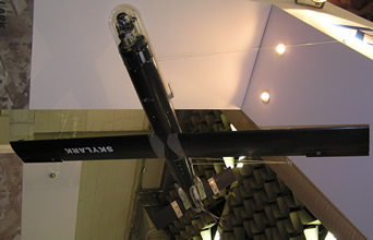
    Future tactical observation systems pursued by the IDF will utilize the new miniature D-STAMP day and night payloads under development by Controp, as part of IDF/MOD development program. The fully stabilized payload weighs only 650 gr. D-STAMP is deployed with the Elbit System’s Skylark miniature UAV and is setting the baseline for future MAVs platforms considered by the IDF.

    PNR-500 (Personal Net Radio) developed by Tadiran Communications is a UHF personal communicator designed specifically for intra-squad and combat team communications. The system can accommodate an internal or external GPS and links to peripheral devices over a distance of 10 – 100 meters, via wireless Bluetooth connectivity. Such devices include rugged PDA, headsets, video cameras, sensors and displays etc. IAI/MLM is offering a simpler communications device called “Personal Location Unit” – a lightweight (350gr.) device, programmed to transmit five structured messages, ‘panic’ button transmitting high-priority emergency message, the device has built in GPS location and two-way modem supporting C4I and live training exercises.

     < page 6 out of 10 > Start – Previous –  Next

    Integrated Systems for AFVs

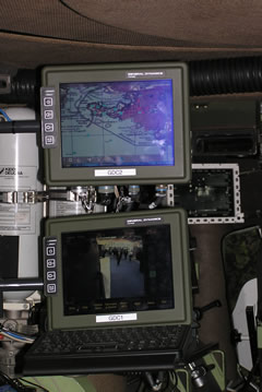
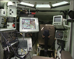
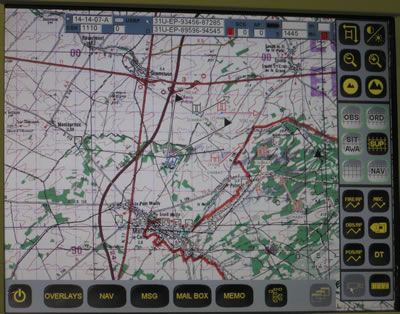
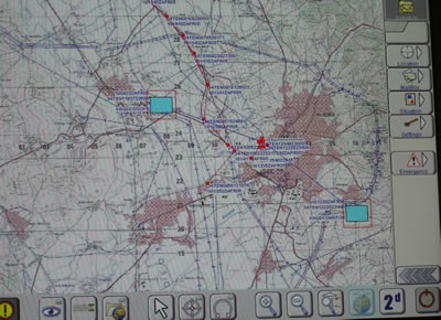
    Tight integration between sensors, weapon systems and command levels is already reflected throughout all levels of the Israel Defense Forces. The armor and mechanized units are receiving elements of “Battle Management Systems” (BMS). These units developed by Elbit Systems, integrate the vehicle’s sensors such as tank commander’s thermal sights, navigation and communications systems. The sight images, viewed by the tank commander, can be transmitted and shared by other crew members of his unit, as well as by commanders at higher echelons.

    Elevated views of the area, as captured by a UAV, and other elevated sensors can also be shared by all units, equipped with Tadiran Spectralink’s vehicular Tactical Video Receiver (V-TVR). The user can tune into the channel of a specific sensor, presenting the video and telemetry on the vehicle’s digital display. Similar equipment is used by helicopter pilots, to receive UAV sensor data directly from the UAVs, en-route to their target. Similar devices are also provided to dismounted commanders, equipped with the V-Rambo kit – comprising miniature receiver, and wrist display.

     < page 5 out of 10 > Start – Previous –  Next

    Panoramic IR Scanners & Stand-Off Measures

    Start < Page 4 of 9 >

    Automatic infrared systems can augment, and sometime replace radars in certain missions. Typical systems are the ADIR, from Elbit Systems and Spider or CEDAR from Controp. Such systems are comprised of a FLIR installed on a rotating plate, scanning a sector of up to 180 degrees, detecting suspicious targets, tracking them and triggering alerts after targets are identified as hostile. The system can track suspicious targets without setting an alarm, until their behavior becomes threatening or as they enter a high security zone, thus enabling effective operation in populated areas. The main advantage such system has over radar is the fact that it actually produces an image, for alarm verification.

    Stand off Countermeasures:

    Even when an effective sterile buffer zone is established between the forces and the surrounding inhabitants, troops must maintain close contact with the population on checkpoints, roadblocks etc. Utilizing advanced technology, such contact can now be initiated at extended range, enhancing the protection of soldiers while also improving cross-language communication. Utilizing the Long Range Acoustic Device (LARD), troops can issue a verbal challenge with instructions at a distance in excess of 500 meters. In Iraq and Afghanistan, LARD systems are integrated with the Phraselator vocal translator, to transmit hundreds of messages in Arabic, and Afghan Pashtu languages. LARD employs directed acoustic signals to which enable troops to communicate over an acoustic beam 15-30 degrees wide, transmitting clear voice or other audible signals.

    Non-lethal weapon systems can be employed in the “sterile” zone, to act as early warning and deter innocent people from entering the restricted area. Non lethal area denial weapons are ranging from sticky or slippery foams and liquids, eliminating movement within buildings, or streets, to stun guns and electronic shock inducers, used to immobilize vehicle’s electrical systems. Two of the most recent area denial systems are the M-5 Modular Crowd Control Munition (MCCM) and Taser Anti-Personal Munition (TAPM) both are a less than lethal mines, MCCM is loaded with rubber balls instead of steel pellets exploding when triggered by tripwire or sensor input. TAPM uses Taser electrical shock devices and can disable any human target by remote control or self activation. Such devices are used to deter, disorient and temporarily incapacitate assailants, separating them from innocent bystanders. Further into the future, troops could utilize Active denial System (ADS) directed energy non-lethal weapon system developed by Raytheon for the Air Force Research Labs. ADS projects a focused millimeter wave energy beam which induces intolerable heating sensation on an adversary’s skin and cause that individual to be repelled without injury. ADS could be used to stop, deter and repel hostile elements without applying of lethal force.

    Additional parts of this article: